Earth Observatory Science Earth Observatory The Stormy Southwest Pacific Earth Earth Observatory Image of the Day EO Explorer Topics All Topics Atmosphere Land Heat & Radiation Life on Earth Human Dimensions Natural Events Oceans Remote Sensing Technology Snow & Ice Water More Content Collections Global Maps World of Change Articles Earth Matters Blog Blue Marble: Next Generation EO Kids Mission: Biomes About About Us Subscribe 🛜 RSS Contact Us Search Even as the unusually quiet 2026 storm season winds down in the North Atlantic, seas have begun to stir on the other side of the world in the Southwest Pacific.
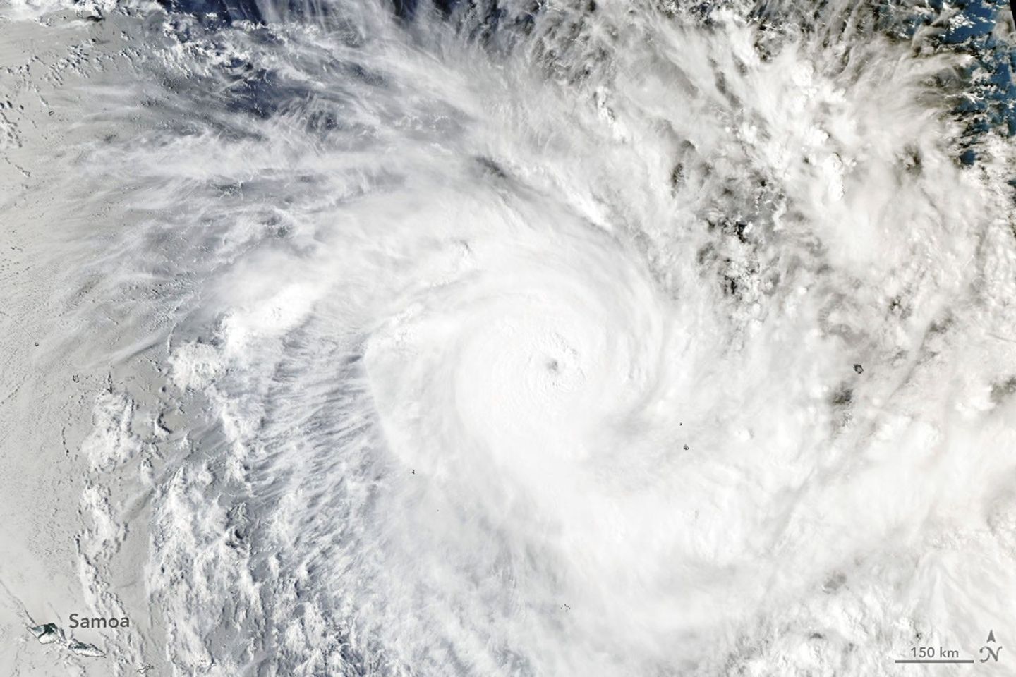
On November 15, 2026 , the Fiji Meteorological Service began issuing updates about a slow-moving tropical disturbance northeast of Samoa and the Cook Islands. Within just a few days, it had become one of the most intense November tropical cyclones the region has seen in decades.
On November 15, 2026 , the Fiji Meteorological Service began issuing updates about a slow-moving tropical disturbance northeast of Samoa and the Cook Islands. Within just a few days, it had become one of the most intense November tropical cyclones the region has seen in decades.
Named Xavier , the system intensified rapidly , thriving in an environment with minimal wind shear and sea surface temperatures of 29 degrees Celsius (84 degrees Fahrenheit)—well above the threshold required to sustain and strengthen developing tropical cyclones .
Xavier was the basin’s second named storm of the season, following only Wati , a short-lived storm that emerged in October.
As Xavier developed, NASA satellite data showed the storm churning along the southwestern edge of a massive tongue of warm water spanning from the west coast of South America to the central Pacific—a telltale sign of the El Niño that has been present in the region since June .