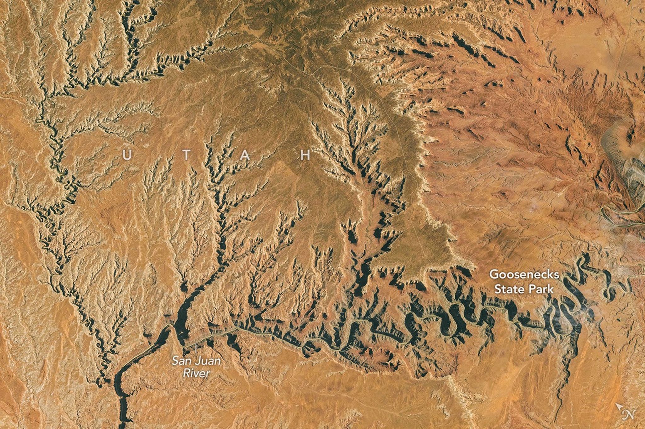
Earth Observatory Science Earth Observatory Taking a Gander at Utah’s… Earth Earth Observatory Image of the Day EO Explorer Topics All Topics Atmosphere Land Heat & Radiation Life on Earth Human Dimensions Natural Events Oceans Remote Sensing Technology Snow & Ice Water More Content Collections Global Maps World of Change Articles Earth Matters Blog Blue Marble: Next Generation EO Kids Mission: Biomes About About Us Subscribe 🛜 RSS Contact Us Search October 6, 2026 Tens of millions of years ago, the San Juan River in what is now southern Utah shared some characteristics with today’s Mississippi River.
In a bygone geologic era, the San Juan flowed across a relatively flat plain that formed in an ancient marine environment. Unencumbered by rugged terrain, the river was free to take a long, meandering path on its gradual journey downslope. But this part of the San Juan changed when geologic forces pushed the Colorado Plateau upward.
In a bygone geologic era, the San Juan flowed across a relatively flat plain that formed in an ancient marine environment. Unencumbered by rugged terrain, the river was free to take a long, meandering path on its gradual journey downslope. But this part of the San Juan changed when geologic forces pushed the Colorado Plateau upward.
Some experts think that within the later stages of this “ still-enigmatic ” history, starting around 20 million years ago, the plateau’s rise elevated the San Juan’s headwaters , which increased the river’s gradient and sped its flow.
With that, the water’s erosive power intensified, and the river started carving its winding path deeper and deeper through 300-million-year-old rock.
Today, on its westward path to Lake Powell, the San Juan River flows through an impressive series of entrenched meanders, also known as “goosenecks.” An astronaut aboard the International Space Station photographed the stark desert topography on October 6, 2026. In Utah’s Goosenecks State Park , the river runs through a canyon 1,000 feet (300 meters) deep.